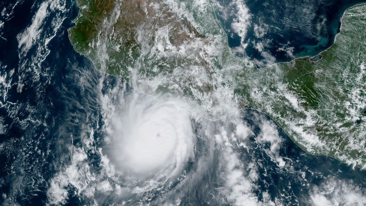
(CNN) — The rapid intensification of Hurricane Otis in the hours before it impacted southern Mexico is a symptom of the human-caused climate crisis, according to scientists, and an increasingly frequent phenomenon. When it happens just before landfall, as is the case in Otis, it can catch coastal communities by surprise, which have little time to prepare.
The intensity of the hurricane was one of the fastest recorded by meteorologists to date: maximum wind speeds increased by 185 km/h in 24 hours. Only one other storm, Hurricane Patricia in 2015, exceeded Otis’ strength in eastern Pacific records, increasing to 193 km/h in 24 hours.
Rapid intensification refers to when a storm’s winds intensify rapidly in a short period of time. Scientists have defined it as an increase in wind speed of at least 56 km/h over 24 hours or less and generally requires significant ocean heat. he National Hurricane Center Otis strengthened so quickly on Tuesday that it “intensified explosively,” he said.
Otis “made the most of a warm patch of ocean” with a temperature of about 31 degrees Celsius, more than enough to fuel a massive storm, said Brian McNoldy, an atmospheric scientist at the University of Miami.
According to the National Oceanic and Atmospheric Administration, more than 90% of global warming over the past 50 years has occurred in the oceans. In addition, an El Niño phenomenon is occurring in the Pacific Ocean this year, causing ocean temperatures to increase.
Otis’ strengthening “was very unusual. It’s unfortunate that it happened just before landfall, but if it had happened over the open ocean, it would have been very noticeable,” McNoldy said.
Tropical storms typically take several days to become powerful hurricanes, but with human-caused climate change, rapid intensification is becoming a more common phenomenon, said Susana Camargo, a hurricane expert and professor at the Lamont Earth Observatory of Columbia University.
“It is very rare for severe storms to make landfall in the eastern Pacific Ocean in Mexico,” Camargo told CNN. Only one hurricane, a Category 1 Max, in 2017, made landfall within 80 kilometers of Acapulco, according to a CNN analysis of National Oceanic and Atmospheric Administration (NOAA) data.
“But we have an El Niño year, which makes the eastern North Pacific more active than usual, and on top of that there is climate change caused by human activity,” Camargo said.
The worrying trend of rapid intensification in the Atlantic Ocean has also been recorded.
a Recent study It found that Atlantic hurricanes may now be more likely to weaken from a weak Category 1 storm to a major Category 3 storm in a 24-hour period than between 1970 and 1990.
according to 2019 studyBetween the 1980s and the early 2000s, Atlantic hurricanes showed a “highly unusual” increase in their rapid intensification, a trend the report said could only be explained by human-caused climate change. Even more alarming is that scientists have found that the strongest storms intensify significantly, making the deadliest hurricanes even more dangerous.
Rapid intensification has historically been difficult to predict, but as oceans warm due to climate change, scientists are confident it is a phenomenon that will occur more often.
“All this just confirms what we expected,” Camargo said.

“Music buff. Social media lover. Web specialist. Analyst. Organizer. Travel trailblazer.”

:quality(85)/cloudfront-us-east-1.images.arcpublishing.com/infobae/TEQF6EONZRFGLLLDIDD4L2O4EE.jpg)

:quality(75)/cloudfront-us-east-1.images.arcpublishing.com/elcomercio/XU32LRAEZFDDPNVHLFU3CKVBYY.jpg)


More Stories
Sheinbaum, Galvez, Mainz campaign wrap-up, news and more
Sheinbaum and Mainz’s CDMX campaign wraps up: Road Alternatives and Street Closures
Ortega attacks Humberto Ortega and declares him a “traitor to the country”