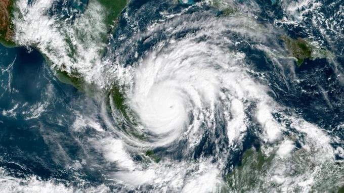
Currently, it is more common to observe hurricanes rapidly intensifying and the probability that one of these events will reach high levels seems to be increasing, a researcher warned in a teleconference broadcast from the National Autonomous University of Mexico. UNAM).
The company said in a statement released on Saturday: Purdue University researcher Don Chavas He spoke before academics and students of UNAM’s Institute of Atmospheric Sciences and Climate Change (ICAyCC) in the cycle of “Current Panorama of Atmospheric Science and Climate Change” conferences.
Expert in Applied Mathematics and Atmospheric and Oceanic Sciences from the University of Wisconsin-Madison, recalls Hurricane Patricia, which hit Mexico in 2015 with 345 km/h winds, as an example of rapid intensification.
“And we’ve seen this type of behavior more often, and I think there’s probably still a consensus and peak intensity is more difficult,” he said.
Also, he said, “It’s complicated to say whether the storms will strengthen,” but he pointed out that they also saw “a greater number of hurricanes reaching higher sizes,” which he pointed out is a “sign.”
Savas, who holds a PhD in Atmospheric Sciences from the Massachusetts Institute of Technology (MIT), gave a talk on using experimental laboratory models to understand tropical cyclones on Earth, explaining that studies with computer models allow the behavior of the phenomena to be known and studied in detail. and simulate their changes.
The use of these systems shows their complexity, enables experiments to change things, as well as provides climate forecasts, he said, and has allowed for progressive monitoring of storms and hurricanes such as Katia, Irma and Hurricanes. In 2017, Jose, like Sandy (2012), caused $65,000 million in damage.
The researcher noted that a significant number of scientists in the world are “trying to answer questions about how the planet warms and what can be expected in terms of speed and minimum pressure, so it is hoped that by using computational models it will be better understood what is happening.”
Savas, an expert in the study of tropical cyclones, severe weather, risk analysis and modeling and their social impacts, said that “one of the data that is expected to be communicated is temperature. Ocean, important information to determine the maximum intensity potential” to know what is happening.
Recent studies by his team show that the intensity of hurricanes has been affected by climate change, but Earth may be at a point where precipitation will increase and their intensity and frequency will increase.

“Music ninja. Analyst. Typical coffee lover. Travel evangelist. Proud explorer.”

:quality(85)/cloudfront-us-east-1.images.arcpublishing.com/infobae/TEQF6EONZRFGLLLDIDD4L2O4EE.jpg)

:quality(75)/cloudfront-us-east-1.images.arcpublishing.com/elcomercio/XU32LRAEZFDDPNVHLFU3CKVBYY.jpg)


More Stories
Earthquake in the US today, Wednesday, May 29 – Earthquake’s exact time, magnitude and location via USGS | USGS | composition
President Arrivalo is left with no alternatives to dismissing the Attorney General
Passenger dies after jumping off world’s largest cruise ship in Florida